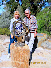
Description: A ramble around the boundary of the Nature Reserve along the ACT/NSW border and up to Oak Hill trig [798m]. Back down through the reserve to Mulligans Flat Road.
Walk distance: 6km
Walk rise: 690m_800m
Walk map: NSW topographic map 1:25000 8727-4S Hall
Start place: Mulligans Flat Road [Gundaroo Road] x Duke Road at locked border gate.
Start grid ref: 971080
Start GPS: UTM Zone 55H 697085E, 6108027N elevation 690m
Start location: 15km N Canberra City
Location map:
Walk 9 -
2009 aerial photography from ACTMAPi:
ActmapiPDF_Mulligans_OakHill -
Walklog: This was a easy stroll uphill following the border fence on the ACT side along a rough track. On the other side of the fence Duke Road reaches a locked private gate at 972084. Looked for the old border survey marker posts without much success until near the top of Oak Hill [800m]. Crossed the fence at a convenient gap [fallen tree] at 961088. Skirted around the side of Oak Hill to reach the summit with panoramic views of Canberra and Woden [24km] and the country out to the windfarm at Bungendore [25km]. Just trying out text & background highlighting for effect here.
Relics of border survey in 1911
Just down the hill from the summit trig we found a fine example of an original survey peg still embedded in the ground with 'CT ' [Commonwealth Territory] marked on one side and the upright arrow on the other.
The original survey field book [1911] for this section of the border is online at http://www.actpla.act.gov.au/__data/assets/pdf_file/0014/4514/A0151.pdf and in book A151 at p18 there is a detailed sketch map of the Oak Hill trig area. This has been scanned and copied below; the extent of the surveyed area in this sketch from Oak Hill trig to corner 64 is about 1km. The surveyed border is essentially a series of connected straight lines listed in this sketch in columns 'Line, Bearing &'Distance'. Distances [length of lines] used in the survey are links [about 0.2m]; the bearings are I believe relative to true north. The list headed 'Corners' refers to blazed trees in the proximity of the corners, with bearings & distances from the corners to the trees given accurately. Any such trees still standing would be well over 100 years old!!
The 'Permanent Marks' are either gas pipes or concrete blocks. On our walk we could see no evidence of any blazed trees, though there were some trees that might have been blazed at the time of the survey. Lockspits made of lines of rocks could be seen at several corner posts marking the direction of the boundary line.
Old fence line predating border survey
At the point on the border fence corresponding to point F between corners 60 and 61[GPS 696555E, 6108924N, 755m] a solid corner post from an original fence predating the survey is still visible. This marked the NE corner of block 224; marked on the survey as a 6-wire fence, and still visible running up the side of Oak Hill. Block 224 was cut in half by the survey of the ACT/NSW boundary in 1911. The northern edge of block 224 can still be seen as a cadastral boundary in current NSW topographical maps.
Day & date: Wednesday 02 SEP 2009
Start time: 0930
Walking time: 3h
Weather: Fine, sunny, light winds 16C
Sun: Rise ,transit , set .
Labels
- 2-Day Walk (1)
- ACT (1)
- Cotter (1)
- IVV (1)
- Lake George (2)
- MapConnect (3)
- Misery Hill (1)
- Misery Point (1)
- Mrs Blundells house (1)
- Mt McDonald (1)
- Mulligans Flat (1)
- Oak Hill (1)
- Riverside (1)
- Uriarra Settlement (1)
Notes & maps on some walks in and around Canberra. The walks vary from 10 to 30km. All are undertaken at an easy pace. Wednesday is my usual walk day. To join in send an email.
Links to useful websites
Blog Archive
Wednesday, September 2, 2009
Subscribe to:
Comments (Atom)


